All DYN codes share:
DYNCFT simulates 3-dimensional contaminant transport with dispersion and first-order decay and/or linear equilibrium adsorption. Conservative constituents (such as chloride and tritium) may be simulated as well.
DYNCFT is based on the Lagrangian approach ('Random Walk" method for statistically significant number of particles, each particle having an associated weight, decay rate, and retardation).
DYNCFT can also be used for transport modeling of dissolved contaminants, without variable density fluids.
DYNCFT's features:
DYNSWIM is DYNSYSTEM's saltwater intrusion simulation model. DYNSWIM simulates a sharp saltwater- freshwater interface, using a mathematical representation of two-phase flow. It is fully 3D, and has all of the basic modeling characteristics of DYNFLOW, including steady state or transient, and the capability of simulating multiple interfaces.
DYNTRACK is the primary companion mass transport model for DYNFLOW. DYNTRACK inputs flow fields from DYNFLOW, and simulates dissolved contaminant fate and transport in 3D aquifer systems, using the random walk method. DYNTRACK also performs particle tracking, and has the ability to "backtrack" for such purposes as defining zones-of-capture of pumping wells.
In the plume simulation mode, DYNTRACK simulates advection, dispersion, molecular diffusion, first-order decay, and adsorption/ retardation. In addition, it has an associated module called DYNOPT used in the calibration phase to estimate the contribution from the different source locations and time periods.
The core of DYNSYSTEM is the fully 3-dimensional flow code, DYNFLOW, which evolved from the MIT-developed AQUIFEM code in the 1970s. DYNFLOW is a comprehensive finite element code, proven during hundreds of practical applications. DYNFLOW simulates fully 3-D multi-layer aquifer systems and allows a wide range of stresses and boundary conditions to be applied. It also has 1D elements for simulating multi-layer wells, underdrains, and fractured rock interconnections, and 2D elements which can represent fault barriers and slurry walls. It can run in steady state or transient mode, and allows for input data updating at any time step during transient runs. DYNFLOW has standard fixed head, fixed flux and 3rd type (head dependent flow) boundary conditions, plus special "rising water" and "pond element" features.
Advanced Capabilities:
The stream/river package referred to as DYNRIVER. DYNRIVER was developed to provide the ability to simulate dynamic river and groundwater interaction and related river diversion and irrigation activities.
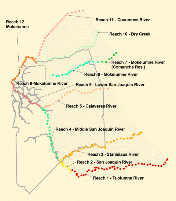
Surface Water Diversions and Irrigated Areas in DYNFLOW
The river network(s) within a groundwater model are specified by the user as a series of linked river reaches. For each river reach a property set is defined that includes river bed width, bank angle, Manning's n, maximum flow depth, tortuosity, river bed thickness and vertical hydraulic conductivity. For each system within the model domain, the user specifies the down stream river stage, inflows, and diversions. DYNFLOW calculates the flow in or out of the stream to the groundwater under saturated and unsaturated conditions. Runoff from rainfall or irrigation activities is also calculated and added to the flow. A river flow mass balance table is provided during the simulation that summarizes net inflows and net outflows by river reach. A river result file provides the ability graph simulated river flow or stage at any point within the system.
DYNBIO is a computational code designed to simulate the transport and biodegradation of contaminants, under the influence of oxygen or nutrient availability conditions. It can be used to simulate the transport and biodegradation of two constituents (i.e., contaminant and an oxidizing agent such as dissolved oxygen or nutrients), which are both utilized by microorganisms existing in the aquifer media.
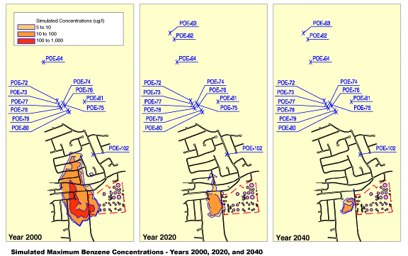
DYNTRACK/DYNBIO Simulation of Benzene Plume Biodegradation
The crop/land use package, referred to, as DYNAG was developed to handle agricultural activities and their impact on saturated groundwater flow. In many groundwater basins with extensive agricultural activity accurate groundwater pumping records are not available making model development and calibration difficult. To address this issue DYNAG was developed. The principal feature of DYNAG is the ability to compute groundwater pumping based on irrigation requirements of crops/land use patterns. The package uses some of the routines all ready available in the unsaturated DYNSOIL program.
DYNAG handles three types of land uses agricultural, urban and natural. The user may specify agricultural and urban land use by element. Additional information that is required is the evapotranspiration rates for the crops represented in the agricultural areas, and the irrigation efficiency. The model then calculates the net water demand of the element based on the percent of the element that is agricultural, the evapotranspiration rate and irrigation efficiency. The groundwater pumping required to meet this demand is then calculated as the net of the agricultural water demand, recharge due to precipitation, and applied irrigation (for example from surface water sources). DYNAG can be linked with the DYNRIVER package so river diversions can be linked with irrigation activities.
DYNPLOT...
In addition, DYNPLOT has sub-modules for specialized data interpolation and other functions. DYNPLOT interacts with data management codes (such as ACCESS or ORACLE), with Arc/Info files, and with AutoCAD drawings.
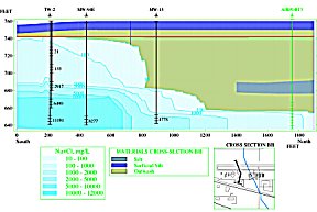
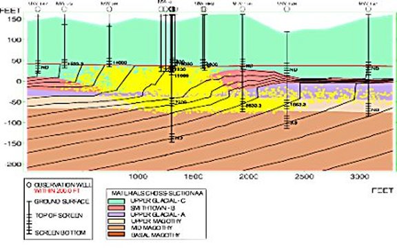
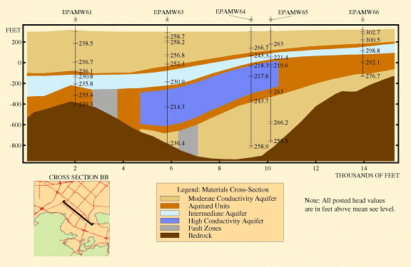
Example Vertical Cross-Section in DYNPLOT
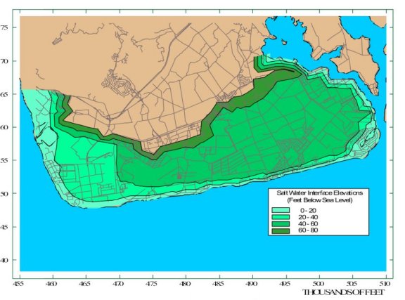
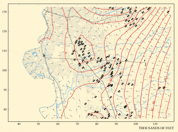
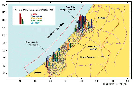
DYNPLOT Used to Display Input Data
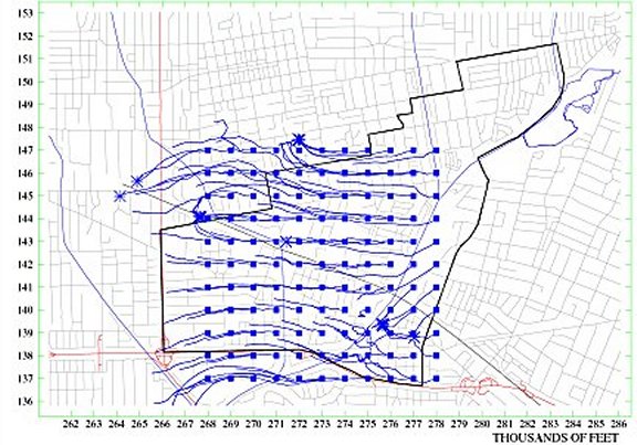
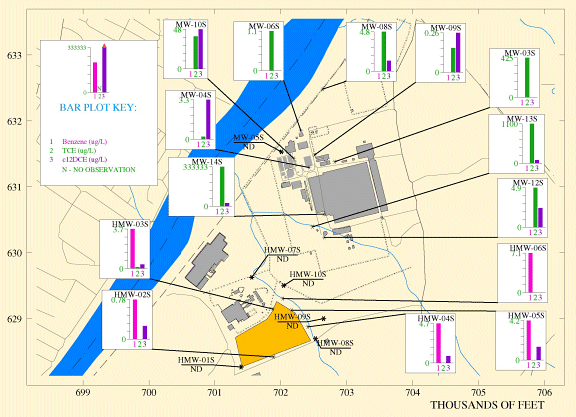
Spatial "Finger-Printing" of Contaminant Data in DYNPLOT
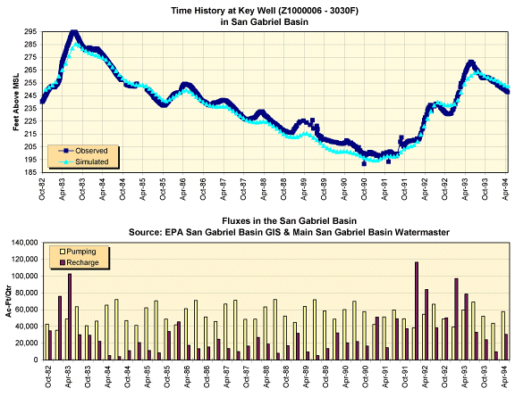
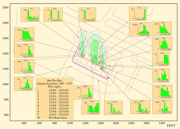
Comparison of Simulated and Observed Contaminant Plume Using Spatial Time-History Plot of Contaminants