Long Island, New York: Regional groundwater management planning
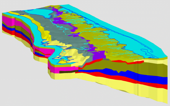
Two projects in Long Island, New York provided a unique opportunity to mate a complex local model with a larger regional model. The Suffolk County Model, shown in 3D here, was created to help manage the regional groundwater supply. It also facilitated seawater intrusion control studies and hazardous waste site assessments.

3D Suffolk County Model viewed in GMS
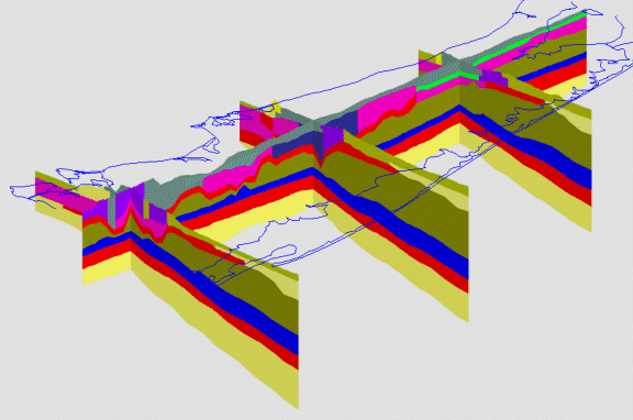
The fence diagram below illustrates the complex stratigraphy that can be implemented in DYNSYSTEM.

Fence Diagram Showing Model Stratigraphy